1978-FEB-02 |
1978-FEB-02 |
| Democratic Republic of the SUDAN | SOUTHERN SUDAN Autonomous Region | UPPER NILE Province : Upper Nile Directorate | WESTERN UPPER NILE Region | |
 |
 |  |  |
|
| (Khartoum) | (Juba) | (Malakal) | (Bantiu) |
 |
LEER County |

|
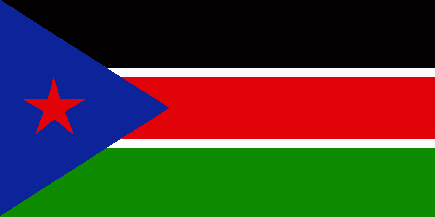
| Flag or Logo since 1978-02-02 | (Emblem or Symbol of UPPER NILE) |
 President Gaafar Muhammad Numairy (ruler of SUDAN since 1971-07-22) |
| Capitals & administrative places: | Leer (Leer) |
|
| Official & national languages: |
|
| LEER | LEER County (Leer) | Local: | LEER County (Leer) |
Other Territories or Entities within the 2024's internationally recognized Country boundaries: |
| BAHR EL GHAZAL | BAHR EL GHAZAL Province : Directorate of Bahr El Ghazal (Wau) |
| BUHEYRAT | LAKES Province : El Buheyrat Directorate (Rumbek) |
| EASTERN EQUATORIA | EASTERN EQUATORIA Province (Juba) |
| ILEMI TRIANGLE | ILEMI TRIANGLE Zone [Kenyan Administration] (Ilemi) |
| JONGLEI | JONGLEI Province : Jungoli Directorate (Bor) |
| LIWAN | CENTRAL ILEMI Area (Liwan) |
| NAMURUPUTH | NAMURUPUTH Territory (Namuruputh) |
| SHILLUKLAND | State of the Shilluk Kingdom of CHOLLO (Kodok) |
| SOUTHERN SUDAN | SOUTHERN SUDAN Autonomous Region (Juba) |
| UPPER NILE | UPPER NILE Province : Upper Nile Directorate (Malakal) |
| WATHA PETH HILLS | Sudan Patrol Line Area : WATHA PETH HILLS Area (Lokwor) |
| WEST EQUATORIA | WEST EQUATORIA Province : Western Equatoria Directorate (Yambio) |
| |
|
|
ethnia.org © J.-M. Merklin |
|

|