1975-OCT-01 |
1975-OCT-01 |
| AUSTRALIA | Commonwealth of AUSTRALIA | Land District of KENT | |
 | |  |
|
| (Canberra) - () - | (Canberra) | (Dover) |
 |
MACQUARIE ISLAND Nature Reserve |

|
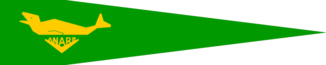
| Flag or logo since 1965-01-01* | Emblem or Symbol* |
|
|
| Capitals & administrative places*: | Anare Station on Macquarie Island (Anare Station on Macquarie Island) |
|
| Official & national languages: | English (en) . |
|
Other Independent or Semi-Independent Polities within the 2024's internationally recognized Country boundaries: |
| AUSTRALIA | Commonwealth of AUSTRALIA (Canberra) |
Other Territories or Entities within the 2024's internationally recognized Country boundaries: |
| ASHMORE ISLANDS | Territory of ASHMORE ISLANDS (Ashmore) |
| CARTIER ISLAND | Territory of CARTIER ISLAND (Cartier) |
| COCOS KEELING ISLANDS | Territory of COCOS KEELING ISLANDS (Bantam Village on West Island) |
| ELIZABETH AND MIDDLETON REEFS | ELIZABETH AND MIDDLETON REEFS Group (-) |
| KING GEORGE THE FIFTH LAND | District of KING GEORGE THE FIFTH LAND ((Hobart)) |
| LARRAKIA | LARRAKIA Community [Claim of Kenbi Land] (Nightcliff + Kulalak) |
| LORD HOWE ISLAND | LORD HOWE ISLAND Board (Governor House) |
| NORTHERN LAND | NORTHERN LAND Council ((Darwin)) |
| NURRUNGAR | Joint Defence Facility NURRUNGAR (Nurrungar) |
| PINE GAP | Joint Defence Space Research Facility PINE GAP (Pine Gap) |
| |
|
|
ethnia.org © J.-M. Merklin |
|

|