1991-MAY-27 |
1991-MAY-27 |
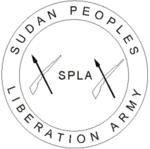
| Sudan People´s Liberation Movement : SPLM | |
 |
|
| (Torit g) |
 |
LEER County |
|
| Flag or logo since 1986-03-01* | (Emblem or Symbol of SOUTHERN SUDAN) |
 Colonel John Garang de Maboir (ruler of SOUTH SUDAN since 1983-06-05) |
| Capitals & administrative places*: | Leer (Leer) |
|
| Official & national languages: |
|
| LEER | LEER County (Leer) | Local: | LEER County (Leer) |
Other Independent or Semi-Independent Polities within the 2024's internationally recognized Country boundaries: |
| SOUTH SUDAN | Sudan People´s Liberation Movement : SPLM (Torit g) |
Other Territories or Entities within the 2024's internationally recognized Country boundaries: |
| AWEIL | AWEIL County (Aweil) |
| BAHR EL GHAZAL | BAHR EL GHAZAL State (Wau) |
| EASTERN EQUATORIA | EAST EQUATORIA Province : Eastern Equatoria Directorate (Kapoeta) |
| EQUATORIA | EQUATORIA State (Juba) |
| ILEMI TRIANGLE | ILEMI TRIANGLE Zone [Kenyan Administration] (Ilemi) |
| JUNGOLI | JUNGOLI State (Bor) |
| KAFIA KINGI | KAFIA KINGI District [Disputed Area part of Buram Province in Darfur] (Kafia Kingi + Hofrat Al-Nahas) |
| LIWAN | CENTRAL ILEMI Area [Pro-Ethiopian Dassanetch Control] (Liwan) |
| NAMURUPUTH | NAMURUPUTH Territory (Namuruputh) |
| SHILLUKLAND | State of the Shilluk Kingdom of CHOLLO (Kodok) |
| UPPER NILE | UPPER NILE State (Malakal) |
| WATHA PETH HILLS | Sudan Patrol Line Area : WATHA PETH HILLS Area (Lokwor) |
| WEST EQUATORIA | WEST EQUATORIA State (Yambio) |
| |
|
|
ethnia.org © J.-M. Merklin |
|

|