1920-FEB-12 |
1920-FEB-12 |
| GERMANY ALLIED POWERS UNITED KINGDOM LEAGUE OF NATIONS | |
|
|
|
| (Weimar a + Berlin b) - (Neuilly on Seine) - (London a + Westminster lr + Edinburgh s + Windsor r) - (Geneva) - |
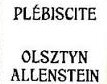 |
Inter-Allied Control Commission of Government and Plebiscite of the Imperial Commissariat of OLSZTYN-ALLENSTEIN District |

|
| Flag or logo since 1920-01-10* | Emblem or Symbol* |
|
| Capitals & administrative places*: | Allenstein (Allenstein) |
|
| Official & national languages: | English (en) . |
|
| EASTERN ERMLAND | EASTERN ERMLAND Area (Ortelsburg) | Local: | OST-ERMLAND (Ortelsburg) |
| ERMELAND | ERMELAND Region (Allenstein) | Local: | ERMLAND (Allenstein) |
Other Independent or Semi-Independent Polities within the 2024's internationally recognized Country boundaries: |


