1920-DEC-15 |
1920-DEC-15 |
| Republic of ECUADOR | COAST Region [Littoral Region] | |
 |
 |
|
| (San Francisco of Quito) | (Santiago of Guayaquil) |
 |
MANABI Province |

|
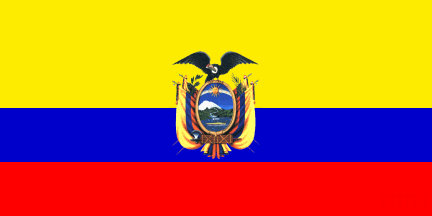
| Flag or logo since 1900-01-01* | Emblem or Symbol* |
 President Jose Luis Tamayo Teran (ruler of ECUADOR since 1920-09-01) |
| Capitals & administrative places*: | San Gregorio of Portoviejo (San Gregorio de Portoviejo) |
|
| Official & national languages: | Spanish (es) . |
|
| BOLIVAR-MANABI | BOLIVAR Canton (San Agustin of Calceta) | Local: | Cantón BOLÍVAR (es) (San Agustín de Calceta) |
| CHONE | CHONE Canton (Saint Cajetan of Chone) | Local: | Cantón CHONE (es) (San Cayetano de Chone) |
| JIPIJAPA | JIPIJAPA Canton (San Lorenzo of Jipijapa) | Local: | Cantón JIPIJAPA (es) (San Lorenzo de Jipijapa) |
| MONTECRISTI | MONTECRISTI Canton (Montechristi) | Local: | Cantón MONTECRISTI (es) (Montechristi) |
| PORTOVIEJO | PORTOVIEJO Canton (San Gregorio of Portoviejo) | Local: | Cantón PORTOVIEJO (es) (San Gregorio de Portoviejo) |
| ROCAFUERTE | ROCAFUERTE Canton (Rocafuerte) | Local: | Cantón ROCAFUERTE (es) (Rocafuerte) |
| SANTA ANA | SANTA ANA Canton (Santa Ana of Vuelta Larga) | Local: | Cantón SANTA ANA (es) (Santa Ana de Vuelta Larga) |
| SUCRE-MANABI | SUCRE Canton (Saint Antonio de Morga of the Bay of Caraquez) | Local: | Cantón SUCRE (es) (La Villa de San Antonio de Morga de la Bahía de Caráquez) |
Other Independent or Semi-Independent Polities within the 2024's internationally recognized Country boundaries: |
| ECUADOR | Republic of ECUADOR (San Francisco of Quito) |
Other Territories or Entities within the 2024's internationally recognized Country boundaries: |
| COLUMBUS ARCHIPELAGO | COLUMBUS ARCHIPELAGO Insular Territory (Asylum of Peace + San Cristobal) |
| ECUADORIAN INDIANS | INDIAN Peoples of Ecuador ((San Francisco of Quito)) |
| UPPER CENEPA | UPPER CENEPA Area (Tiwinza) |
| |
|
|
ethnia.org © J.-M. Merklin |
|

|